
“Calques” for your GPS (Marcel Goll)
Many years ago, Mario Labelle created ‘calques’ for the Club des Cent Cols, for locating cols on paper maps. Here I show a simple tool to create an equivalent to calques, with all the cols you require, for your Garmin GPS. In place of the calques themselves, it consists of a transparent ‘point cloud’ that can be superimposed on the map on your GPS.
What you need :
- GPX files containing names and coordinates of your cols.
- Installation of Java version 6 or later. Note that IMGfromGPX is a 32 bit program, and if you have Windows 64 bit, you will need to install the 32 bit version of Java here. For MAC it is here.
- Installation of the program IMGfromGPX available from Javawa for PC or MAC.
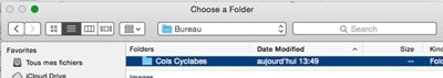
- Make a folder that contains the relevant GPX files (Cols cyclables in this example)
Nothing else.
After installing IMGfromGPX, this is what you see when it starts :
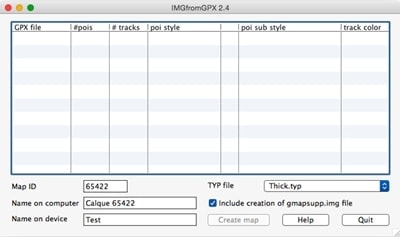
- • You must fill in the map ID. Type a high number, so as not to conflict with the IDs of the Garmin maps or maps for Garmin that you have. Personally, I always use 654nnn.
• Next you fill in the map name on your cmputer. This is the name that BaseCamp and/or MapSource will use. Fill in a name for your device while you’re at it. Take the same name as on the computer.
• Insert the column ‘GPX file’ your GPX files.
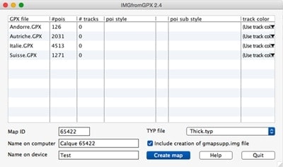 The ‘pois’ column shows the number of cols.
We will now specify the style of POI. ‘Geographic Points’ seems appropriate. On the line of the GPX folder click on the colmn ‘POI style’.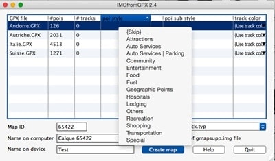
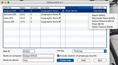
Then in the column ‘POI sub style’ we choose the symbol which will represent a col. Here I have chosen ‘Peak (6616)’, but my preference is for the little square of ‘Nature Reserve’.
Next make your folders, your style and your symbol.
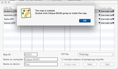
Now you need to activate ‘create map’.
You specify the target folder.
The process continues.
JI am sure that on a MAC the installation of the map is different to on a PC.
In the folder ‘Cols cyclables’ we have :
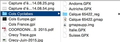
It is advisable to rename the file gmapsupp.img to calque.img This avoids deleting a gmapsupp.img file which might already be on your GPS.
To install in BaseCamp on a MAC we double click on the file .gmap.
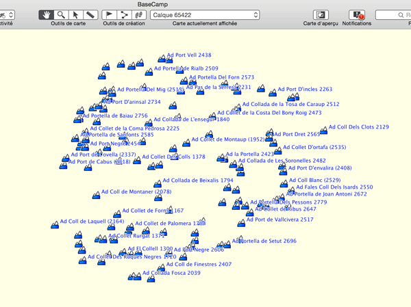
If you open BaseCamp you obtain.
The last map installed being automatically active :
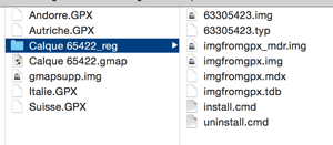
For a PC, we return to the target folder. We have a folder .reg, here
Calque_65422.reg
All you need to do is click ‘install cmd’ to install the map for MapSource.
On your GPS
Just copy the file calque/gmapsupp.img into the Garmin folder of the GPS or of its SD card.
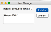
Check your Maps Manager that the calques map is there.
For each GPS you will play with the map’s settings so that the points only appear at the desired zoom level.
In our example the IMG file is only 630kb for 8000 cols, so it will not slow down your GPS.
You can use this ‘calque’ with your own preferred POIs.
A calque/map of climbed cols may also be useful.
Don’t forget to change the symbols.
The POI search tool on your GPS can find the POIs on your map.
Marcel Goll