FR-06 Tende East – MTB 79 Km, D+2539m – 20 cols

Author’s description

Author: René Rial

Route: completed on 07/09/2016

Start: The southern exit from the village of Tende, on the D6204. Alt : 824 m

General description

The municipalities of Tende and La Brigue are located in the extreme east of the Alpes Maritimes, bordering with Liguria and Piedmont. The numerous military works encountered along the way are witnesses to an eventful history in this area. The Sanctuary Notre-Dame-des-Fontaines of La Brigue (km 10.2) has a remarkable fresco dating from the 15th century.

Many panoramas are offered along the way.

20 cols

1 Col Linaire FR-06-1430

2 Baisse de Sanson Ouest FR-06-1694  Bassa di Sanson IT-IM-1685b

3 Baisse de Sanson Est FR-06-1680a Colla di Sanson IT-IM-1696 

4 Pas de Colle Ardente FR-06-1599  Passo di Collardente IT-IM-1600

5 Baisse des Fraches FR-06-1599a Baisse Fraches IT-IM-1599

6 Col de la Lariée FR-06-1956

7 Pas du Tanarel FR-06-2045 Passo del Tanarello IT-CN-2045

8 Col de Gravairole FR-06-2250 Col de Gravairole IT-CN-2250

9 Col Roux FR-06-2175 Colla Rossa IT-CN-2175

10 Col de l’Evêque FR-06-2161 Col de l’Evêque IT-CN-2161

11 Col de la Celle Vieille FR-06-2099 Col de Celle Vieille IT-CN-2099

12 Col des Seigneurs FR-06-2111 Colle dei Signori IT-CN-2111

13 Col de Marguareis FR-06-2085

14 Col de Chevolail FR-06-2235

15 Col de la Boaïra FR-06-2102 Colle della Boaria IT-CN-02102

16 Col de la Perle FR-06-2086  Col de la Perle IT-CN-2086

17 Colletto Campanino IT-CN-2142

18 Col de Cannelle FR-06-1882  Col de Cannelle IT-CN-1882

19 Col de Tende Est FR-06-1890  Col de Tende Est IT-CN-1890

20 Col de Tende Ouest FR-06-1871  Colle di Tenda IT-CN-1871

Optionnal:
Colle di Capoves FR-06-2207 Colle di Capoves IT-CN-2212 (off the track, 30 m to the right, 5 m higher, off the path)

Technical description

After Notre-Dame-des-Fontaines, we go up by a long and beautiful road track (R1/2) until the Pas de Tanarel. Then follows a series of cols on mostly rideable paths only requiring some pushing (sometimes difficult) until the Col de Celle Vieille (S2/3). Then we again find a road track R1/2 until the road Col de Tende. A series of 48 hairpins leads back to the village of Tende.

Key Words : Centcols,Tende,Tenda,Saint Dalmas de Tende, La Brigue,

Openrunner link, interactive map, profile, gpx track: https://www.openrunner.com/route-details/6593420

This itinerary is offered as an indication. The author disclaims his responsibility and that of the Club des Cent Cols by virtue of imponderables due to the cyclist himself, the equipment used and everything concerning the road, tracks and paths, their surroundings and other users of them.

Here, a exhaustive overview of the Club des Cent Cols member courses.

Photos

Album photo : https://photos.app.goo.gl/C88VUYadbEtxqpqd9
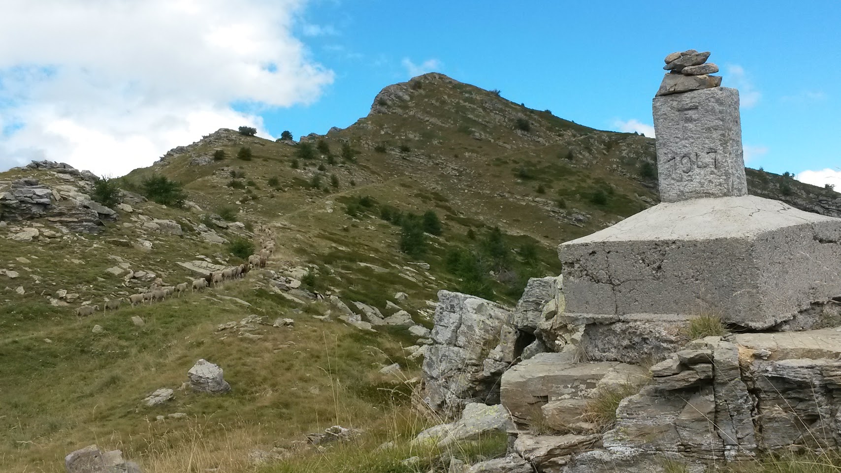
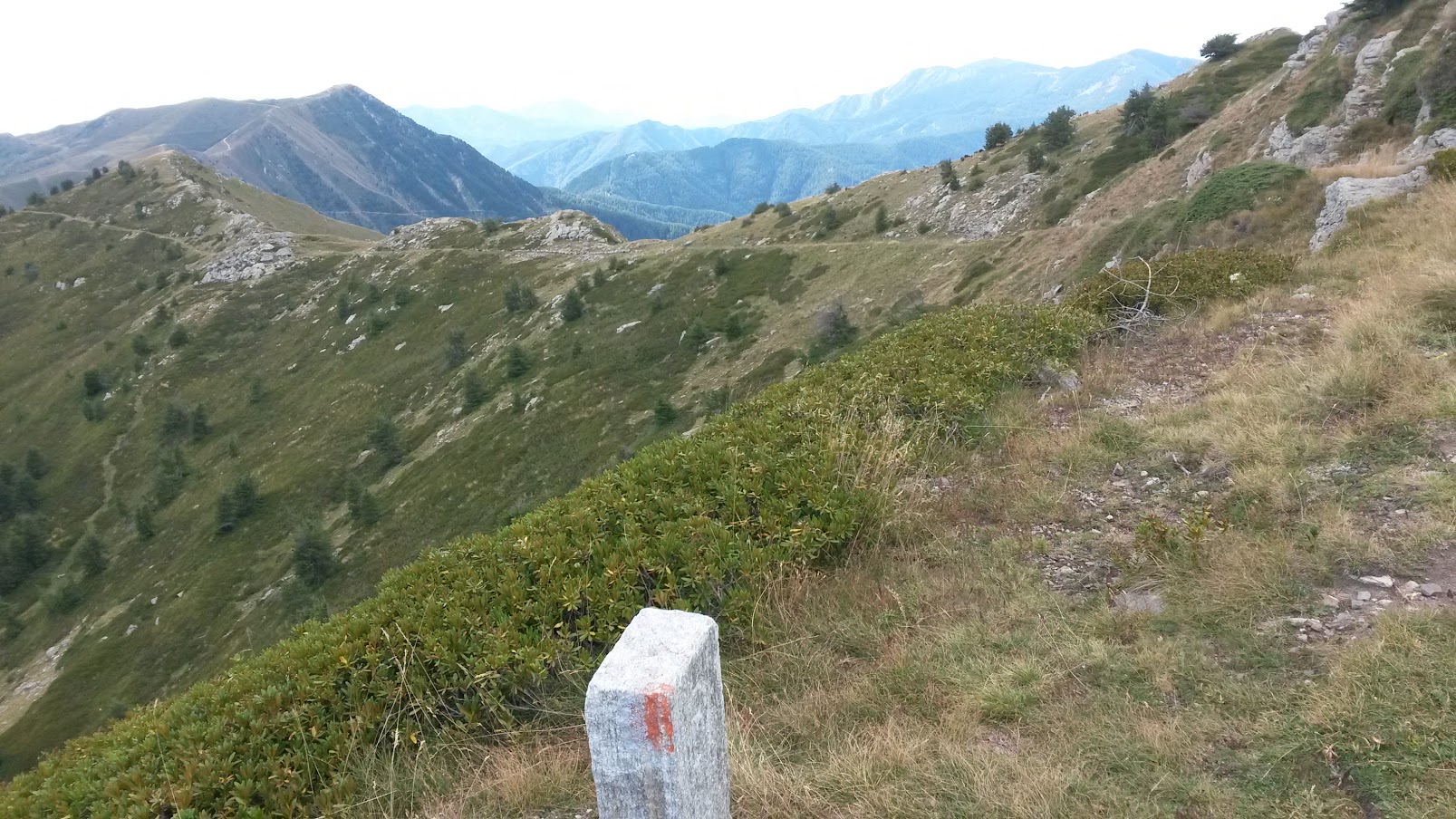
The ridges of Tende

L’attribut alt de cette image est vide, son nom de fichier est 8202.jpg.
Col Linaire
L’attribut alt de cette image est vide, son nom de fichier est 2204.jpg.
Pas de Colle Ardente
L’attribut alt de cette image est vide, son nom de fichier est 2303.jpg.
Pas du Tanarel
L’attribut alt de cette image est vide, son nom de fichier est 6401.jpg.
Col de Gravairole
L’attribut alt de cette image est vide, son nom de fichier est 4601.jpg.
Col de l’Evêque
L’attribut alt de cette image est vide, son nom de fichier est 3902.jpg.
Col des Seigneurs
L’attribut alt de cette image est vide, son nom de fichier est 3200.jpg.
Col de la Perle
L’attribut alt de cette image est vide, son nom de fichier est 5201.jpg.
Colletto Campanino
L’attribut alt de cette image est vide, son nom de fichier est 8901.jpg.
Col de Cannelle
L’attribut alt de cette image est vide, son nom de fichier est 9103.jpg.
Col de Tende Est

Dans la catégorie : Members Riders

FR-81 Saint-Antonin-Noble-Val – Road 73 km, D+1091m, 11 cols

FR-39 Col du Coda – Mont Poupet – Road 99 Km, D+2157 m, 1 col

FR-70 Great East Meeting 2023 – Road 51 Km, D+1474m, 2 cols

FR-70 Great East Meeting 2023 – MTB 36 Km, D+1228m, 4 cols

CH-TI Erbonne and Bocchetta d’Orimento – Road 64 Km, D+1551m, 1 col

DE-BW The Black Forest Wehr Road 28 Km, D+643 m, 1 col

DE-BW The Black Forest Schonach – Gravel 40 Km, D+1504m, 14 cols

DE-BW The Black Forest Schiltach long – Gravel 68 Km, D+1672m, 18 cols

DE-BW The Black Forest Schiltach short – Gravel 50 Km, D+1580m, 7 cols

DE-BW The Black Forest Oppenau – Gravel 62 Km, D+2023m, 17 cols

DE-BW The Black Forest Oberrotweil – Gravel 37 Km, D+864m, 10 cols

DE-BW The Black Forest Niederweiler North – Gravel 57 Km, Gravel, 11 cols

DE-BW The Black Forest Haslach im Kinsigtal West – Gravel 87Km, D+2541m, 20 cols

DE-BW The Black Forest Haslach im Kinsigtal East – Gravel 69 Km, D+2129m, 18 cols

DE-BW The Black Forest Gremmelsbach – Gravel 68 Km, D+2017m, 12 cols

DE-BW The Black Forest Gaggenau – MTB 120 Km, 2752m, 12 cols

FR-38 The plateau d’Emparis – MTB 41 Km, D+1417m, 4 cols

FR-2A The Cruzzini valley – Road 87 Km, D+1654m, 4 cols

FR-83 The Maures Massif – Road 90 Km, D+1159m, 5 or 6 cols

FR-2B In the heart of the Agriate Desert – Gravel 35Km, D+714m, 8 cols

DE-BW The Black Forest Biberach West – Gravel 50 Km, D+1243m, 6 cols

FR-2A Between Gravona and Prunelli – Road 94 Km, D+1874m, 6 cols

FR-2B The Crêtes du Niolu – MTB 46Km, D+1487m, 7 cols

ES-B Dosrius – Gravel 27km, D+589m, 6 cols

FR-54 Grand Est Regional meeting 2022 – Road 44 Km, D+486m, 3 cols

FR-54 Grand Est Regional meeting 2020 – Road 69 Km, D+806m, 6 cols

FR-06 Tende West – MTB 49 Km, D+1644, 7 cols

ES-GR Pico del Veleta – Gravel 102 km, D+ 3005 m, 9 cols

FR-2A Piana, Les Calenche, Porto – Road 102 Km, D+2377, 10 cols

FR-2A The mountain of Cagna – MTB 22 Km, D+529m, 5 cols