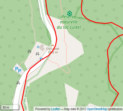
Col Luitel
The Col Luitel (FR-38-1262),
For a member of the club de Cent Cols, this name always ‘rings a bell’ because it recalls the creation of the club : it was after climbing this col in 1970, that Jean Perdoux had the idea to create : ‘the Club des Cent Cols’ before he wrote the rules in 1972.
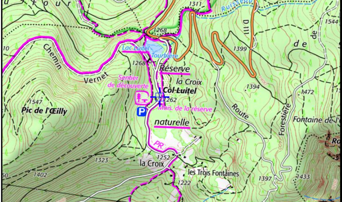
For a Grenoblois going to ski at Chamrousse, « the Luitel », was at the crossroads of the D111 (from Uriage to Chamrousse) and the narrow road that descends to Séchilienne … below the start of the Arselle ski de fond pistes … but no, the col is 500 metres from there, in the middle of the Luitel nature reserve.
This (indisputable) position corresponds at the same time to the position on the IGN map, the localisation by the Club des Cent cols, and the of the position of the wooden sign showing Col Luitel 1262 m.
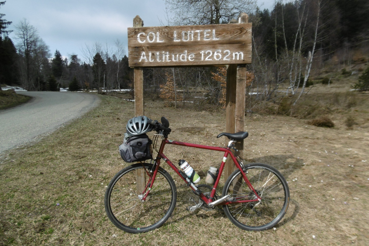
Verification on the ground in May 2020 : But where exactly is the Col Luitel ?
Toponymye
Luitel : is the name of the col, the lake, the peat bog and the nature reserve.
According to this article from the Bulletin of the Société Botanique de France (page 150) « The historic documents on the Luitel are practically inexistant. Rare are the old texts that refer to it ; The Isère archives tell us nothing interesting about it. The most we can find sometimes cite the names of Lauvestellum, Lutet, Luther, then Luytel and Luitel »(i).
Geographical situation
Massifs
The col Luitel is located in the south of the Belledonne range
Geology
In this place, more than 50000 years ago, an arm of the Romanche valley glacier slowly advanced by the Col Luitel. This veritable grinding continued to cut more or less deep depressions here (from 11 to 16 m.). Lake Luitel, originally much bigger was formed during the retreat of the glaciers. Constantly fed by waters, the lake was partly transformed into a bog by the strength and accumulation of vegetable debris. At
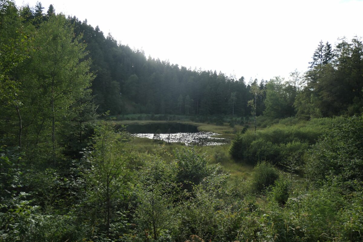
The tourbière The Lac Luitel
Hydrography
Lake Luitel is located to the north of the col. It is fed by the Rambert Stream that comes from the Arselle plateau (marsh). The lake’s outlet is located close to the hairpin bend of the D111 (coming from Uriage), just before the junction with the Séchilienne road. Lower down flows the Prémol Stream, a tributary of Grande Maille Stream at Vaulnaveys-le-Bas, itself a tributary of the Romanche at Vizille.
The clearing of snow from the Chamrousse road using salt and the water run-off lead to the transfer of significant quantities of salt towards the Lake Luitel and its marsh. See the study : « Les effets des épandages de sel sur la tourbière lacustre du Luitel (massif de Belledonne, France) : la dérivation des eaux du ruisseau du Rambert comme remède à la pollution ». (Revue de Géographie Alpine Année 2003 91-1 pp. 51-66)
Towards the south Bruyant Stream is a tributary of the Romanche at Séchilienne
Acces
From Grenoble (Palais des sport 23.5 km, 213 m), Giéres (at 20 km, alt ; 227 m), Uriage (at 13 km, alt 412m) by the D524, MF de Prémol (at 3 km, 1088 m) by the D111, junction D111/ RF (0,5 km – 1268m).
From Chamrousse (Roche Beranger) (alt 1745 m) by the D111 we reach the junction with the Séchilienne road after 7.5 km of descent.
From Séchilienne (alt. 368m) there is a 10 km climb (road C1) to reach the Col Luitel.
Things to see – tourism
At the col
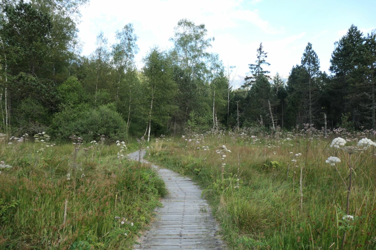
The Réserve Naturelle du lac Luitel, the first in France (1961), contains 17 hectares of ecological sites of peat bogs. Le Lac Luitel owes its existence to the great glaciers of the Quaternary.
The Col Luitel’s marsh was added to the reserve in 1991.
This reserve, comprises two elements : Lake Luitel, a marsh-lake characterised by floating rafts of vegetation, and the Col Luitel marsh, partly wooded. Maintained footpaths allow us to explore this milieu.
Administrative situation
The Col Luitel lies in the community of Séchilienne.
The boundary with the community of Vaulnaveys-le-Haut is at the level of the D111 (Chamrousse road)
Cycling and cycletouring
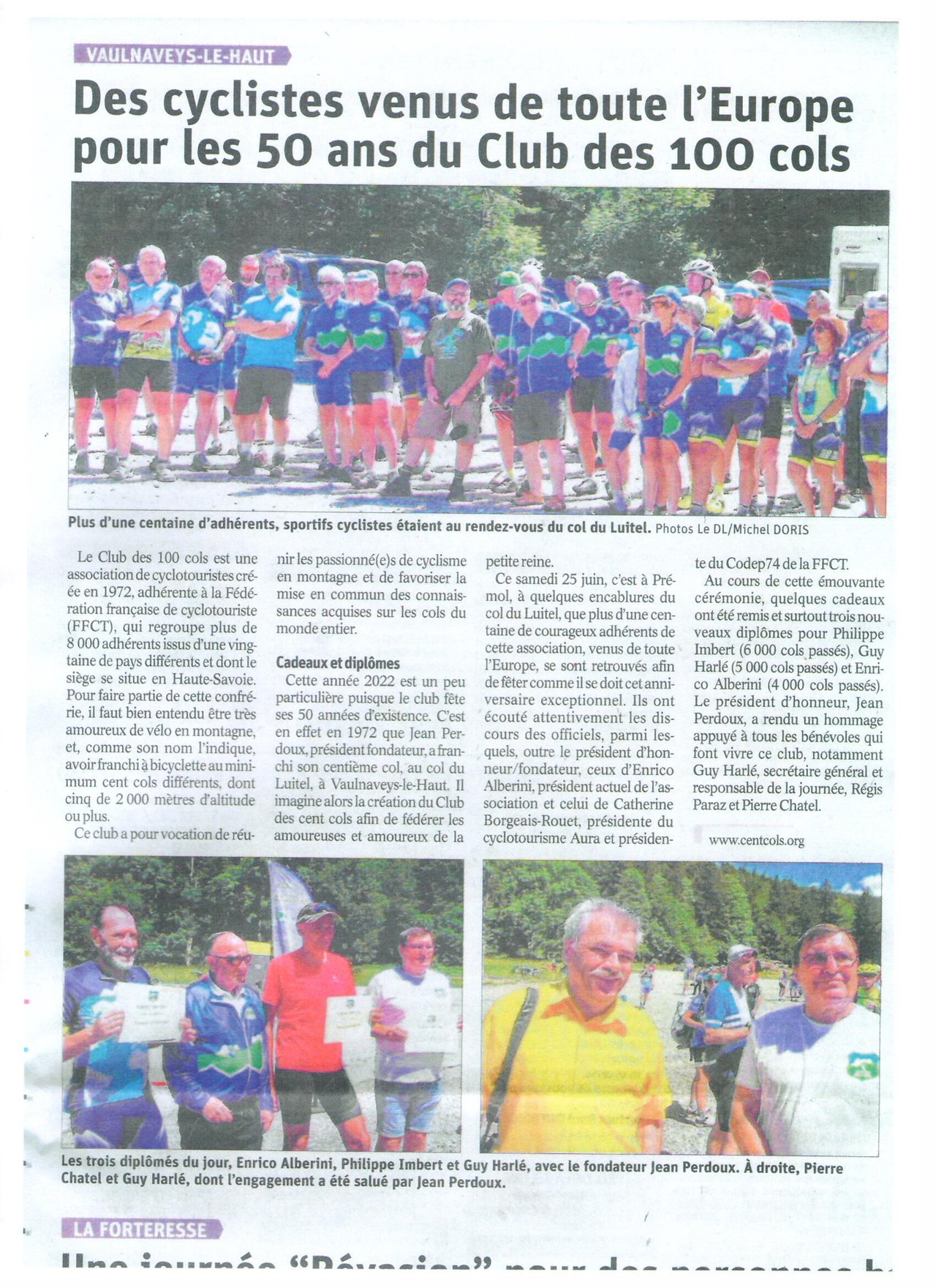
Fiftieth anniversary of the Club des Cents Cols (Dauphiné Libéré)
On Saturday 25 June 2022 the Club des Cent Cols celebrated its 50 years. The get-together, of about a hundred people took place in the car park of the maison forestière of Premol (altitude 1088 m) situated 3 km from the col.
After research and discussions between Guy Harlé, the organiser of the event, and some local cyclists, this place was chosen for its proximity to the col (and the impossibility of holding the get-together at the col itself because of the very small parking area sited alongside the Luitel nature reserve).
It was absolutely necessary to avoid trampling on the reserve …
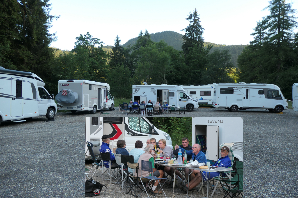
The evening before – the preparations for the get-together
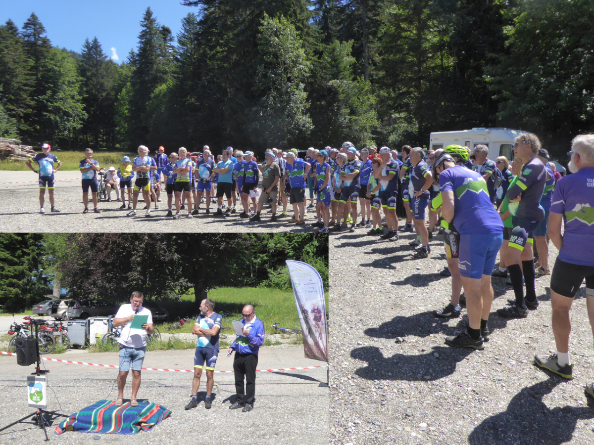
The meeting and the speech by the organiser Guy Harlé
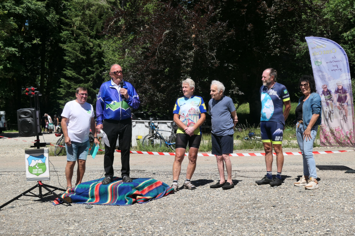
The speech by the founding president Jean Perdoux
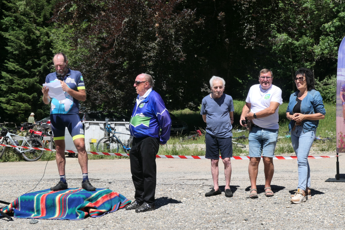
The speech by the current president Enrico Alberini
Profile
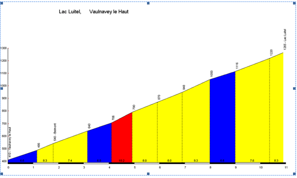
Profile of the Col Luitel from Uriage.
Start : Vaulnaveys le Haut
Length : 10.90 km
Climbing : 855 m
% Average : 7.84%
% Maximum : 10.2%
Cols-cyclisme.com
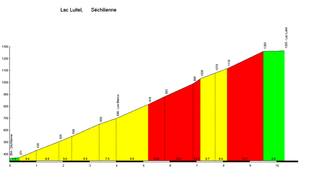
Profile of the Col Luitel from Séchilenne
Start : Séchilienne
Lenght : 10.30 km
Climbing : 901 m
% Average : 8.75%
% Maximum : 14.3%
Cols-cyclisme.com
And, finally, some images on the subject of the COL LUITEL
An article by Gérard Galland
and Bernard Giraudeau (for the geological part)