


Easy finding and listing of cols for future members
You’ve climbed some cols, and maybe more than you think as some don’t have a sign at the top and you may have crossed them without knowing they were named.
You’ve climbed at least 100 cols, including 5 over 2000 m, or you’re nearly there ? It’s time to start thinking about joining the Club des Cent Cols !
Get to know the Rules of the Game to be sure that you’ve « nailed it » ; they will show you, notably, that no proof is required for your cols climbed, your word is quite sufficient.
That done, all you need to do is make up your list of cols. On the page how to do on the Club’s site, we explain how this list is made.
There are several tools available for finding your cols, known or unknown, and listing them.
1 – On the Club’s website (and available to non-members)
11 – Using the CCway app
You can download a maximum of 100 cols as GPX or KLM data (when you become a Club member, the number of cols that can be downloaded will be unlimited).
Once you’ve got the file, and it is opened on Google Earth or another cartographic program, you will be able to see them.
For example :
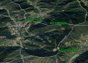
That’s great to see your cols, but it won’t do to make your list because it only shows you the col’s code !
12 – Using the “cols sur trace” app
If you possess a GPX track, this app lets you find all the cols you have done, and to make a list of them with the code, the full name and the altitude (which may well be different to that of the code).
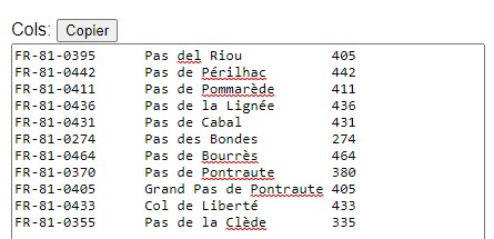
Once this is done, youv’ve got all you need for your entry list.
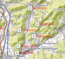
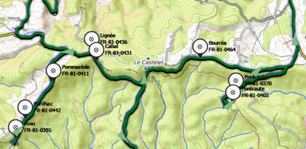
As well as that, the app lets you import the name and the code of the cols on your track to display them on a map program, for example here with Land on a background of World Base Map :
2 – Using OpenRunner

Openrunner is a mapping and itinerary making site, that is a partner of the Club des Cent Cols
On the Club des Cent Cols website, go to JOIN US then HOW TO DO : https://www.centcols.org/how to do
There, follow the tutorial MAKE YOUR LIST WITH OPENRUNNER.
Col by col, you will be able to mark the cols you have done and make up your list of cols.
It wil be much quicker and easier to do if you use the gpx track that you got from « cols sur traces » (cf above § 1-1) : all the cols will be marked on your track.
3 – Using VeloenFrance
Veloenfrance is a site of the Fédération Française de Cyclotourisme
If you are used to this site,
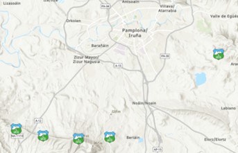
- clicking on the Club logo positioned on each col, will give you its name, its altitude and its category ;
- a further click shows our « visualiser » of the col ; with more information (code, maps, photos, documents)
The only disadvantage, veloenfrance only treats road cols and easily rideable off-road ones (called R1 and S1 in our jargon) for about a dozen European countries.
4 – A final question?
Do you know, for example, where « Foce di Travo », or the » Col de la Bergère » or the « Col de l’Aire dei Masco » or other as obscure cols can be found ?
No ? Its often the same for us : our teams have found more than 100,000 cols worldwide, have validated nearly all, and we know hardly any by heart.
So, take the full name of the col that you are looking for, add centcols.org, and enter it in a search engine like Google or Qwant. For example on Qwant :
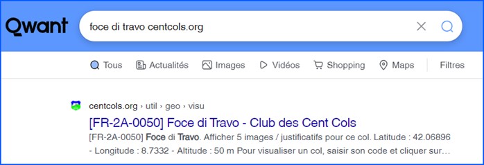
It will be very probable that they will find the col you are looking for and give you all the information on it with photos, even this link :
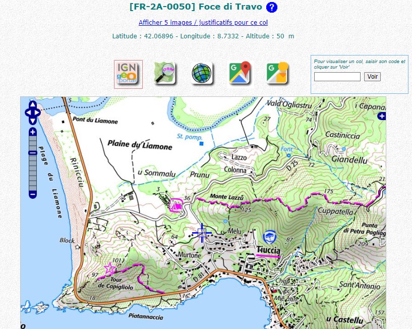
https://www.centcols.org/util/geo/visu.php?code=FR-2A-0050
This link will open our col visualiser :
If, despite all this, you don’t succeed, don’t despair. Contact our vice-president, Nadine Giraudeau, at . She looks after new member subscriptions, and will be delighted to help you.