

The Col du Mollard
Toponomy
In Col du Mollard (FR-73-1638) the name of Mollard, written historically molar or molard, is regularly found in the Alps.
The toponym comes from the Latin molarum that indicates a hamlet sited « on a mamelon — the rounded summit of a hill or mountain — or a small plateau ».
NB : there are two Cols du Mollard in Savoie, the other (FR-73-1320b), an R1, sits in the north part of the Chartreuse massif (on the GR9).
Geographical location
Massif
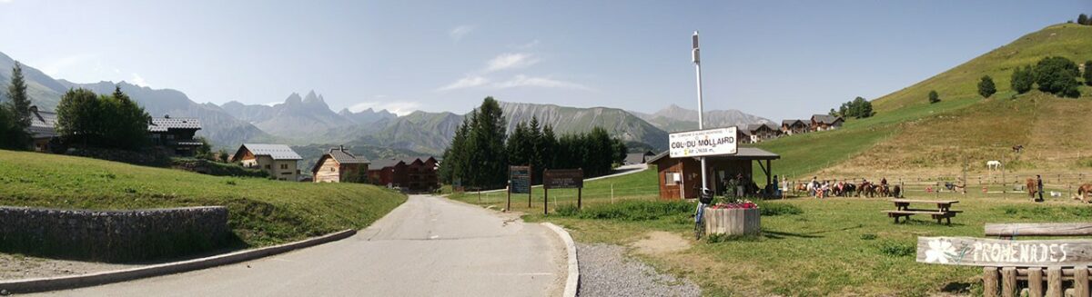
The Col du Mollard lies in the massif des Arves
Geology
The Col du Mollard lies within the Plateau d’Albiez that slopes roughly south to north. This provides a wide shelf untypical of this area. It comes first of all from a coomb that cuts into layers of marne lying horizontally and not folded. This coomb has been enlarged by the Aiguilles d’Arves glacier descending towards the north and then filled in by glacial alluvium.
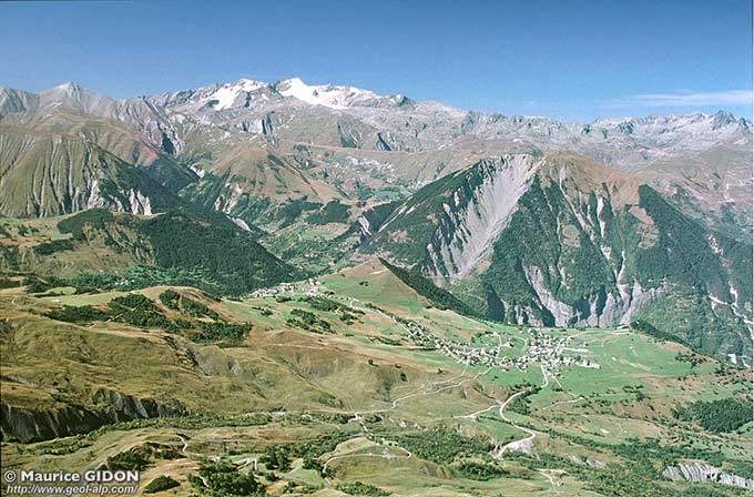
Directly west, Mont Charvin draws our attention by the gaping wound of the Combe Génin cut into the gypsum strata and revealing a row of sharp pinnacles made of cargneule, a limestone rock markedly more resistant to erosion.
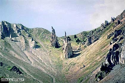
Photos taken from geol-alp.com
Hydrography
To the north the Torrent du Merderel flows between Albiez le Vieux and Albiez le Jeune.
To the south, the waters flow towards the Rieu Gilbert.
These two streams are tributaries of the Arvan (which flows into the Arc).
Administrative situation
The Col du Mollard is located in the commune of Albiez-Montrond (Savoie),Le Col du Mollard est situé sur la commune d’Albiez-Montrond (Savoie),
Le Col du Mollard est situé sur la commune d’Albiez-Montrond (Savoie),
Access and nearby cols
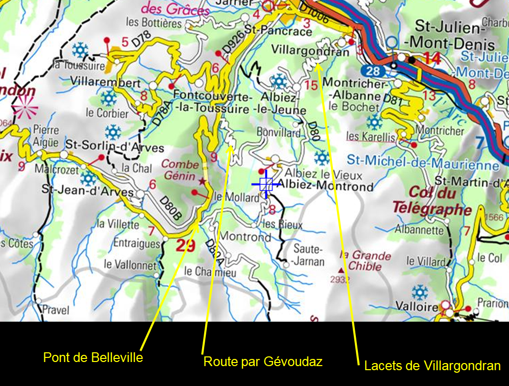
To the south the D80 rejoins the Croix de Fer road – D526 (Saint Jean de Maurienne – Saint Sorlin d’Arves) at the Belleville bridge (1228 m).
To the north the D80, goes through Albiez-le-Vieux, and after Albiez-le-Jeune descends the hairpin bends of of Villargondran to arrive in the Maurienne valley.
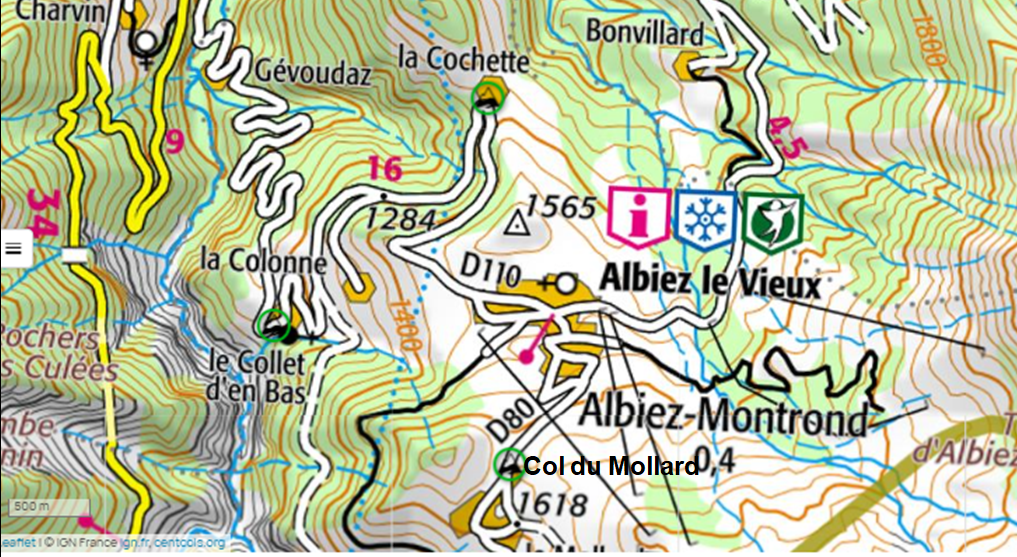
After Albiez-le-Vieux, the D110 gives access to the Arvan valley and Saint Jean de Maurienne via Gévoudaz. This road was taken for the first time by the BRA (Brevet Randonneur des Alpes) in 1979, as a climb (St Jean de Maurienne – Gévoudaz –Albiez).
This road crosses two cols included in the catalogue of the Club des Cent Cols:
La Cochette (FR-73-1355) and Le Collet (FR-73-1150)
For the « purists », note that – even if it is said to lie on the D110 in the CCC catalogue – La Cochette is slightly to the north of the D110, in nthe centre of the hamlet of the same name (voir CCWay – Google Earth).
Things to see
- At Albiez-Montrond (Chemin de l’Adret, le Mollard) : Ecomuseum of past times.
- The Opinel knife was invented by Joseph Opinel (1872-1960) in 1890, when he was only 18 , at Gevoudaz, a hamlet of Albiez-le-Vieux.
Cycling and cycletouring
Tour de France
The Col du Mollard was crossed for the first time by the riders of the Tour de France during the16th stage of the 2006 race.
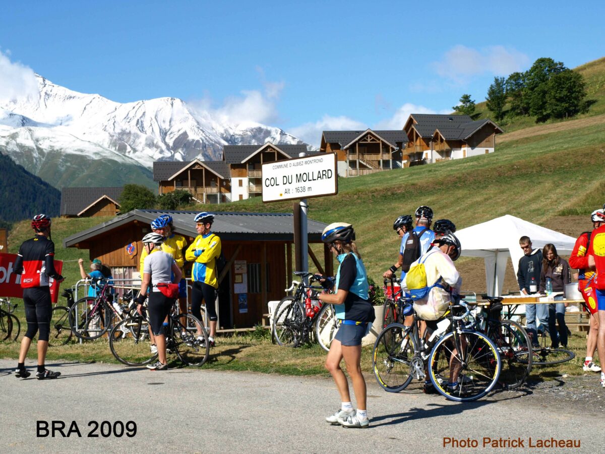
BRA (Brevet de Randonneur des Alpes)
The col was climbed by the participants of the BRA for the first time in 1979 in the direction Maurienne – Col du Mollard.
It was an option in 2017, was not on the programme in 2019 and figured in all the options in 2023 (after the Croix de Fer, from the Belleville bridge).
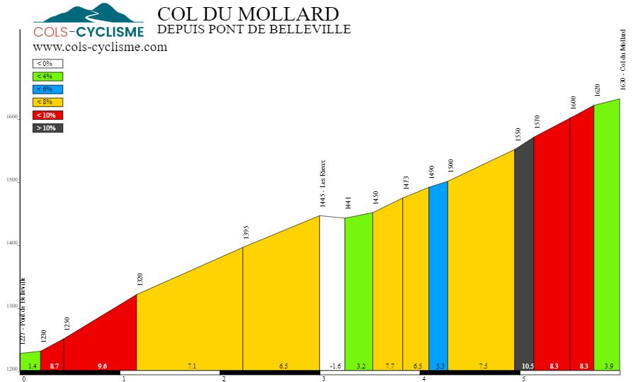
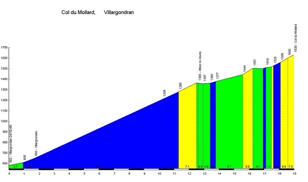
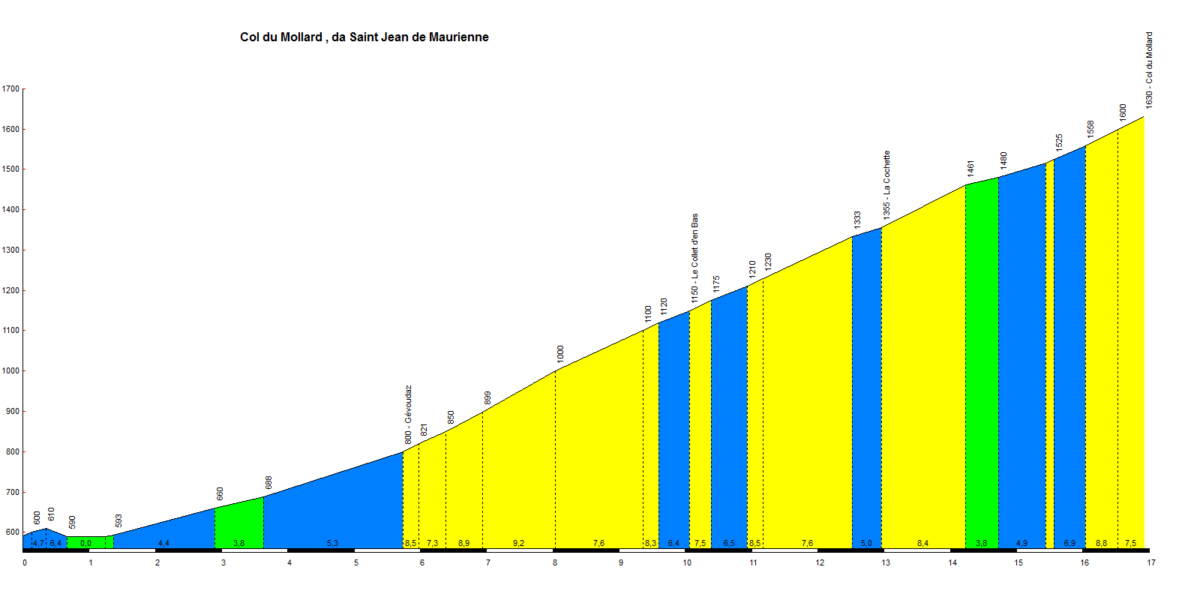
Profile
We can find numerous profiles on the internet.
As an example, these copied from the site cols-cyclisme
An article by Gérard Galland
(with contributions by Jules Arnaud and
Bernard Giraudeau for the geological section)